Autocad Civil 3D
Free
What is Autocad Civil 3D?
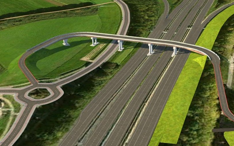
Autodesk Autocad Civil 3D is a solution that creates civil engineering design and documentation that supports Building Information Modeling (BIM) workflows. With the implementation of AutoCAD Civil 3D, it is better to understand project performance, maintain consistency in processes and data, and give a faster response to changes.
What can Autocad Civil 3D do?
- The new features offer pressure pipe functionality, improved survey, base map creation, and new rail.
- Host of transportation features have been enhanced, including corridor composition workflows, 3D navigation and interrogation, and surface boundary definition.
- Using the Export to Civil View for 3ds Max Design Command. Analysing and Editing the Catchment Model in Storm and Sanitary Analysis.
Why Autocad Civil 3D?
- AutoCAD Civil 3D software, part of Autodesk Infrastructure Design Suite, is the Building Information Modeling (BIM) solution for civil engineering design and documentation.
- Extends the value of your model with new workflows and productivity tools for civil infrastructure.
- Stay coordinated and explore design options, analyse project performance, and deliver more consistent, higher-quality documentation.
Learning Outcomes
- Information packed practical training starting from basics to advanced
- Course content designed by considering the review of different companies. We insure we update our syllabus on regular intervals to keep our training in sync with the Industry Need.
- Practical assignments at the end of every session.
- Practical learning experience with live project work and examples.
- We encourage Project based learning.
Who should learn?
- BE / B.Tech / ME / M.Tech, and Diploma in Civil Engineering students and professionals.
- Drafters
- Designers
- Technicians (Transportation, land development & Water Projects)
#BestAutocadCivil3DTrainingInstitute
Course Features
- Lectures 35
- Quizzes 0
- Duration 64- 80 hours
- Skill level Advanced
- Language English & Hindi
- Students 0
- Assessments Yes
-
Introduction to AutoCAD Civil 3D
-
Introduction to Land Survey, Land Development, Tranportation Design
-
Working Environment
-
Worksharing
-
Working with Point Data
-
Import/Export Points
-
Surface
-
Create Points from Surface
-
Creating Survey Database
-
Creating Figure Styles and Prefix
-
LiDAR Survey
-
Working with DEM files
-
Surface Analysis
-
Legend Table
-
Earthwork Calculation
-
Create surface
-
Volume Calculation
-
Grading
-
Xref
-
Parcel
-
Creating Tables
-
Project: Land Development
-
Alignment Design as per IRC
-
Create Widening
-
Profile Design as per IRC
-
Assembly
-
Corridor and Corridor Surface
-
Super Elevation
-
Junction Design: Manual and Automatic
-
Roundabout Design
-
Grading
-
Quantity Takeoff
-
Compute Materials
-
Pipe Network
-
Project: Transportation Design
